 GSNI Data Catalogue
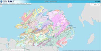
GSNI GeoIndex - Geology theme (WMS Service)
Data from the Geological Survey of Northern Ireland's GeoIndex Geology theme are made available for viewing here. The GSNI GeoIndex is a website that allows users to search for information about GSNI data collections covering Northern Ireland. Access is free, the interface is easy to use, and it has been developed to enable users to check coverage of different types of data and find out some background information about the data. More detailed metadata about the layers contained in this service can be found in the linked resources.
Simple
Identification info
- Date (Publication)
- 2022-01-01
- Citation identifier
- https://gsni-data.bgs.ac.uk/geonetwork/srv/api/records/85a661d2-493d-4bbe-a7f3-37735e568ebb
- Status
- On going
- Point of contact
-
Organisation name Individual name Electronic mail address Role Geological Survey of Northern Ireland
Distributor
- Maintenance and update frequency
- As needed
-
GEMET Thesaurus version 1.0
-
-
Geology
-
- Access constraints
- Other restrictions
- Other constraints
- INSPIRE: no limitations
- Use constraints
- License
- Other constraints
-
Available to view under the Open Government Licence: https://www.nationalarchives.gov.uk/doc/open-government-licence/version/3/
- Other constraints
-
We request that you acknowledge that the resource contains Geological Survey of Northern Ireland materials provided under the Open Government Licence.
- Service Type
- view
- Code
- NIR
))
- Contains Operations
- Unique resource identifier
- EPSG:4326
- Unique resource identifier
- EPSG:29900
- Unique resource identifier
- EPSG:29902
- Unique resource identifier
- EPSG:3857
- Distribution format
-
Name Version
- OnLine resource
-
Protocol Linkage Name WWW:LINK-1.0-http--link
https://mapapps2.bgs.ac.uk/GSNI_Geoindex/home.html GSNI Geoindex
OGC:WMS-1.3.0-http-get-map
https://map.bgs.ac.uk/arcgis/services/GeoIndex_GSNI/GSNI_Geology_Landsat_WMS/MapServer/WMSServer?
- Hierarchy level
- Service
- Other
-
service
Conformance result
- Statement
-
For lineage of datasets served by this service please refer to the metadata for those data.
Metadata
- File identifier
- 85a661d2-493d-4bbe-a7f3-37735e568ebb XML
- Metadata language
- English
- Hierarchy level
- Service
- Hierarchy level name
-
service
- Date stamp
- 2023-11-08T08:32:38
- Metadata standard name
-
ISO 19115:2003/19139
- Metadata standard version
-
1.0
- Metadata author
-
Organisation name Individual name Electronic mail address Role Geological Survey of Northern Ireland
Point of contact